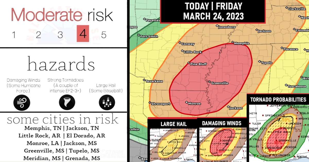
Moderate Risk Issued (Level 4/5) for a Severe Weather Outbreak – This includes all modes of severe weather!
Severe weather outbreaking including the threat of strong intense tornadoes across the Lower Mississippi Valley and Mid-South with the most likely time period between 5 pm to Midnight CDT.

An intensifying QLCS will evolve across AR and spread towards the TN Valley through the evening! This QLCS will likely contain embedded supercell and mesovortex structures supportive of tornadoes (including potential for a few EF2s) and significant damaging wind swaths (up to around 90 mph).

(Tornado Probabilities)
This storm mode will support discrete convection ahead/southeast of the QLCS towards late afternoon into the early evening across the Sabine Valley towards the Ark-La-Miss.

(Damaging Winds Probabilities)
The environment will support supercells, a few of which could become long-tracked. Low-level hodographs, while not quite as enlarged as compared to farther north, will favor a threat of strong tornadoes (EF2-3).

(Hail Probabilities)
Are you prepared?

Now will be a good time to check your weather radios and have several ways to receive watches & warnings!
Download the WeatherBug app to receive free weather alerts! – Know Before | iOS App – Android App
IMPORTANT:
Review your severe weather safety procedures for the possibility of dangerous weather today.
Stay tuned to NOAA Weather Radio, weather.gov, or other media for watches and warnings.


