MODERATE RISK ISSUED – TORNADO OUTBREAK POSSIBLE TODAY!

A significant tornado threat is expected today as intense storms develop.
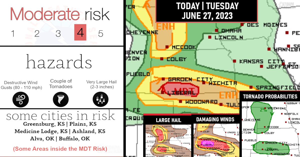
This brings the threat of a few intense and strong long-track EF2-EF3+ tornadoes, very large hail up to 3 inches in diameter, and damaging winds that some could be hurricane force across the southern and central Plains into the lower to mid Missouri Valley.
(Tornado Probabilities)

A regional severe-weather outbreak is expected from north TX across OK into KS with strong tornadoes, very large hail and damaging winds all part of a long-duration threat.
The initial severe/tornado threat has already begun near Caprock from Lubbock to Childress – Despite the unusually early start, there will be the potential for embedded supercells capable of all hazards as the storms overspread western/northern OK into southern KS through midday.
(Damaging Winds Probabilities)

Additional thunderstorm development is likely by early-mid afternoon along this zone and the dryline to the south into TX, and storms will spread generally northeastward toward southern/central OK and southeast KS.
The significant tornado threat will be greatest if semi-discrete supercells can be maintained well into the afternoon/evening.
Very large hail up to 3 inches in diameter can also be expected with the more intense supercells.

The potential for tornadoes with embedded circulation will continue into the overnight hours, along with damaging winds.

THANK YOU to all our subscribers for making these storm chases and weather coverage a possibility.
You can join our community here if interested: http://facebook.com/becomesupporter/livestormchaser