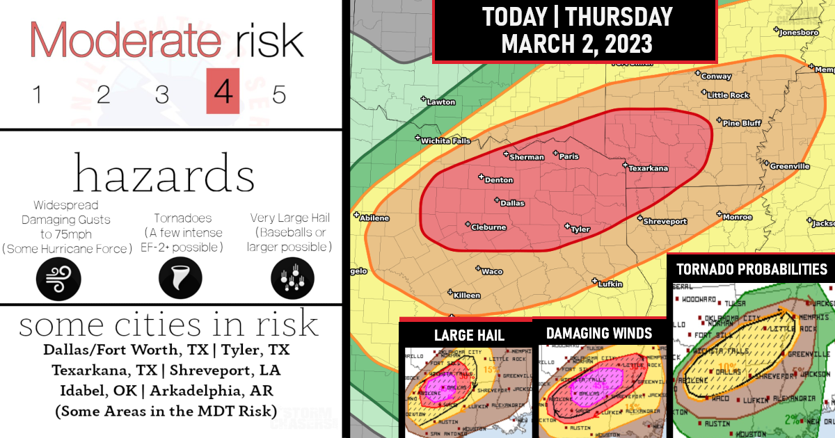
Moderate Risk (Level 4/5) of Intense Storms Today Across North Central Texas into the Arklatex region!

All of the Dallas/Fort Worth metroplex is now under a moderate risk for widespread very large hail to the size of baseballs or larger, significant widespread thunderstorm gusts to 75 mph (some hurricane force), and a couple of strong/intense tornadoes. This threat stretches from north Texas into the ArkLaTex this afternoon through tonight.

The initial storms will likely be clusters of supercells capable of producing very large hail and swaths of damaging winds as storms grow upscale into a line along the surging cold front from central into northeast TX this evening – some of which could produce significant gusts.

The potential for tornadoes, including a strong tornado or two, will be most favorable tonight when storm mode will likely be more linear.

Summery: Severe thunderstorms with very large hail to the size of baseballs or larger, significant thunderstorm gusts to 75 mph, and a couple of strong tornadoes are likely from north Texas this afternoon into the ArkLaTex through tonight!
Widespread damaging winds, some hurricane force, A few intense tornadoes, & Widespread large hail, some baseball size is all possible!

Are you prepared?
Now will be a good time to check your weather radios and have several ways to receive watches & warnings!
Download the WeatherBug app to receive free weather alerts! – Know Before | iOS App – Android App
IMPORTANT:
Review your severe weather safety procedures for the possibility of dangerous weather today.
Stay tuned to NOAA Weather Radio, weather.gov, or other media for watches and warnings.


