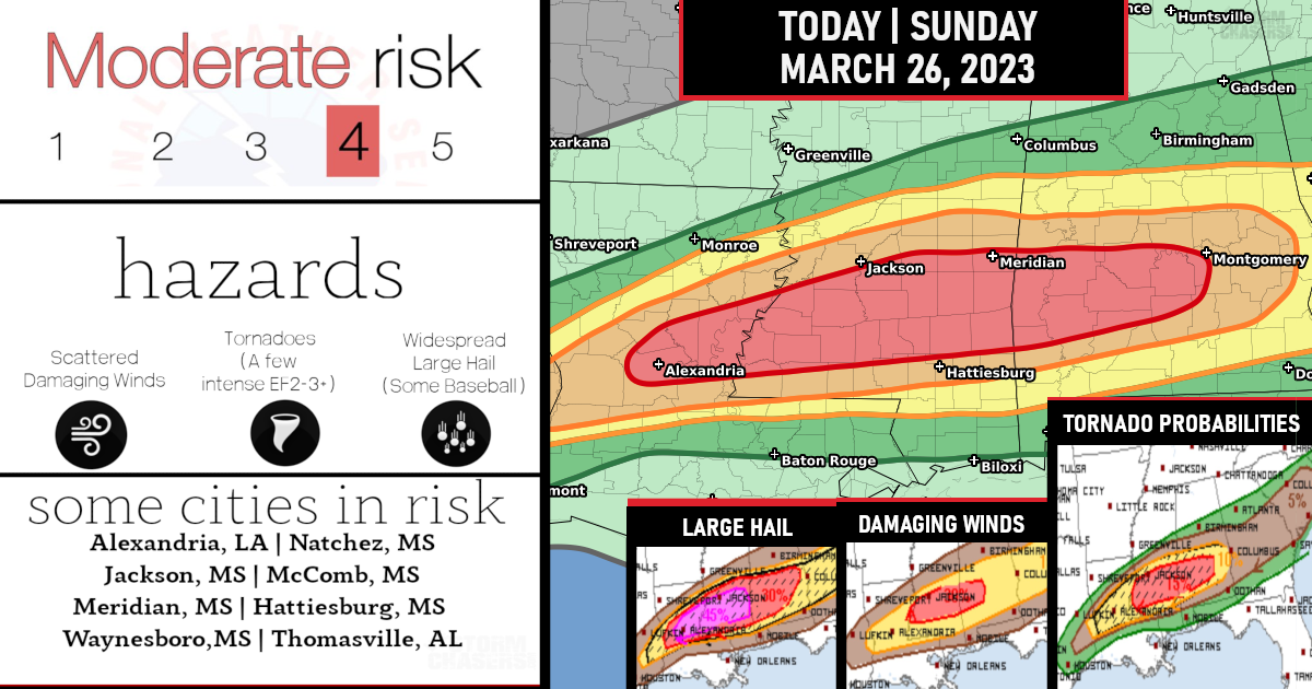
A severe Weather Outbreak is expected today with all modes of hazards expected – a Level 4/5 Moderate Risk has been issued!
As mentioned, a moderate risk has now been issued TODAY for strong tornadoes, a few intense (EF2+), Widespread large hail, some baseball size, & Scattered damaging winds, particularly from central Louisiana across central/southern portions of Mississippi and Alabama this afternoon and evening.

Storms, including initially semi-discrete/intense supercells, will tend to cluster/gradually grow upscale along a boundary with hail/wind potential, but an increased concern for tornadoes, some of which may be strong/intense (EF2+), would exist with supercells that evolve/persist in a semi-discrete manner south of the boundary and move into and/or develop across south-central/southeast Mississippi, and eventually southwest/southern Alabama this evening


Are you prepared?

Now will be a good time to check your weather radios and have several ways to receive watches & warnings!
Download the WeatherBug app to receive free weather alerts! – Know Before | iOS App – Android App
IMPORTANT:
Review your severe weather safety procedures for the possibility of dangerous weather today.
Stay tuned to NOAA Weather Radio, weather.gov, or other media for watches and warnings.


