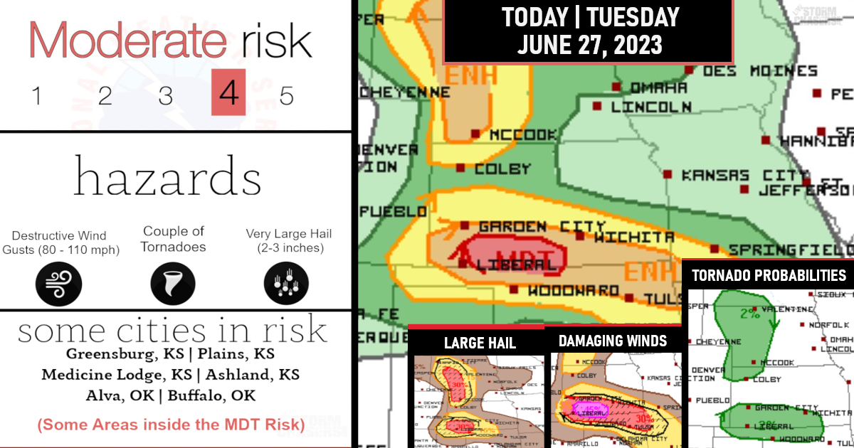
Moderate Risk issued for significant damaging winds of 60-80 mph!

The overall risk also includes large hail of 2-3 inches along with a few tornadoes possible across Illinois and western/southern Indiana.
Other severe storms with large hail and damaging winds gusts are expected across the Tennessee Valley, as well as the central High Plains.

Within the Moderat Risk zone, Significant wind gusts, occasional hail, and some convective line-embedded tornado risk is possible!
Another focused corridor of severe weather will exist from the Lower Ohio Valley southward into the Tennessee Valley – damaging winds and severe hail will be possible into this evening in this corridor.
(Damaging Winds Probabilities)

From the front Range & Central Plains this afternoon/evening, thunderstorm development will become more probable on and immediately east of the higher terrain from Colorado into southeast Wyoming.
Supercells capable of producing large hail of 2-3 inches in diameter, along with some tornado potential.
(Large Hail Probabilities)

Upscale growth into a few clusters will be possible this evening, with an attendant threat for isolated severe-caliber winds.
Some of this evening convection may persist into the overnight hours across southern Nebraska/northern Kansas with some threat for isolated large hail and wind damage, potentially as far east as southwest Iowa/northwest Missouri.
(Tornado Probabilities)

Are you prepared?

Now will be a good time to check your weather radios and have several ways to receive watches & warnings!
Download the WeatherBug app to receive free weather alerts! – Know Before | iOS App – Android App
IMPORTANT:
Review your severe weather safety procedures for the possibility of dangerous weather today.
Stay tuned to NOAA Weather Radio, weather.gov, or other media for watches and warnings