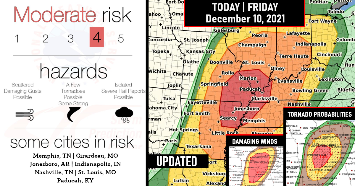
Moderate Risk Issued (UPGRADE) – This is a level 4 of 5 for Strong Tornadoes and Damaging Winds!
An outbreak of severe storms is expected mainly for this evening into tonight and through Saturday Morning! (Friday, Dec 10, 2021)

A few strong tornadoes, damaging gusts, and large hail are all expected beginning this evening across Arkansas and Missouri, with the greatest tornado threat close to the confluence of the Mississippi and Ohio Rivers.
The damaging wind and tornado threat will persist overnight while spreading eastward into the Tennessee Valley and northeastward across the Ohio Valley overnight.
In summary, strong vertical shear will favor supercells capable of producing a few strong tornadoes (some potentially capable of EF2+ damage) and large hail initially, with increasing storm coverage and a greater threat for damaging winds overnight (in addition to a continued tornado threat)

Storms should move quickly enough to limit flooding concerns, but some areas may be on the receiving end of multiple lines of thunderstorms, which would raise the risk of flash flooding.
Following a few showers/weather in the morning hours, there will likely be a period of time during the early afternoon when the rain subsides..
Here is a look at the outlook probabilities
Tornado Probabilities

Damaging Winds Probabilities

Large Hail Probabilities

Outlook By State – Closer Look
Arkansas

Kentucky

Missouri

Tennessee


Are you prepared?
Now will be a good time to check your weather radios and have several ways to receive watches & warnings!
Download the WeatherBug app to receive free weather alerts! – Know Before | iOS App – Android App


