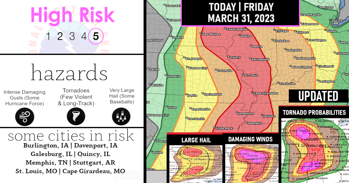
Very dangerous weather outbreak including all modes of severe weather – strong long-track tornadoes!
High Risk has been issued for an outbreak of tornadoes and severe thunderstorms that’s expected over parts of the portions of the Midwest and the lower MS/TN River Valleys this afternoon and tonight!

Numerous tornadoes, several intense and long track, Widespread damaging winds, some hurricane force, & Scattered large hail, some baseball size are all expected!
Within the High Risk, several long-track strong to potentially violent tornadoes are forecast for this afternoon into the evening.

A severe weather outbreak appears increasingly likely, centered on this afternoon and evening, across a large portion of the Mississippi Valley. At least a few long-track, strong to potentially violent tornadoes are probable, particularly over portions of the Mid-Mississippi Valley to the Mid-South.

Swaths of intense damaging wind gusts along with very large hail are expected as well.!

BIG weather day today so please be sure to have more than one way to receive those watches and warnings!
Are you prepared?

Now will be a good time to check your weather radios and have several ways to receive watches & warnings!
Download the WeatherBug app to receive free weather alerts! – Know Before | iOS App – Android App
IMPORTANT:
Review your severe weather safety procedures for the possibility of dangerous weather today.
Stay tuned to NOAA Weather Radio, weather.gov, or other media for watches and warnings


