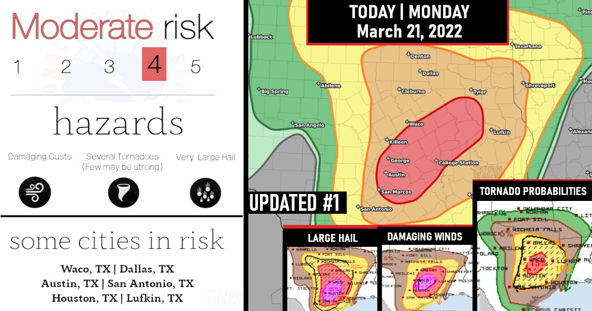

Several tornadoes, including the potential for a few strong tornadoes, along with very large hail and damaging winds are expected this afternoon through tonight, especially across parts of central/east Texas into western Louisiana..

Tornado Probabilities

Potential remains apparently for a couple of long-tracked supercells emanating from near the I-35 corridor in central/south-central Texas east-northeastward into parts of east Texas.
Large Hail Probabilities


All severe hazards will remain possible through the overnight, although!
Looking ahead this system will shift east overnight and into tomorrow across Louisiana and Mississippi where a regional “Tornado Outbreak” – Moderate Risk – is issued!
Tuesday’s Moderate Risk Outlook
A regional severe weather outbreak — including potential for significant/damaging tornadoes — remains evident over the Lower Mississippi Valley/central Gulf Coast region Tuesday.

 ||
||

Severe/tornado risk will continue through the evening/overnight as the cold front — and associated pre-frontal convection — advances.
At this time, it appears risk may extend as far east as eastern Alabama and western parts of the Florida Panhandle late in the period.

Are you prepared?
Now will be a good time to check your weather radios and have several ways to receive watches & warnings!
Download the WeatherBug app to receive free weather alerts! – Know Before | iOS App – Android App


